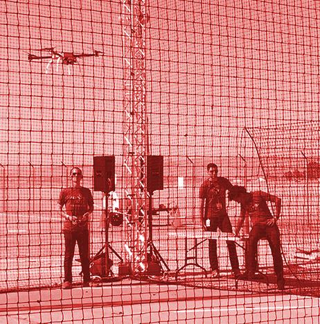
In an effort to enhance its ability to monitor, observe, manage and protect its lands and environmental resources using UAS technology, the Oneida Indian Nation, which is an indigenous nation of American Indian people whose sacred and sovereign homelands are located in Central New York, has partnered with Northeast UAS Airspace Integration Research (NUAIR).
The Nation will leverage NUAIR’s UAS and related technologies, as well as its expertise, to gather and assess data about its lands and environmental resources, mainly from isolated or hard-to-reach areas. The Nation will also use this technology to further implement and enforce programs aimed at protecting these resources.
Data
Data
Trumbull to scale UAS inspections through new contract from ExxonMobil
ExxonMobil has awarded Trumbull a five-year UAS contract to expand its drone data collection and inspections.
One of the first companies in the U.S. approved to conduct UAS operations, Trumbull has supported ExxonMobil since 2014.
“Trumbull is grateful to serve amazing clients. After conducting data collection and inspections for ExxonMobil in over 25 locations, we are excited to scale operations starting in the Americas,” Trumbull CEO Dyan Gibbens says.
“We look forward to helping ExxonMobil integrate amazing safety, efficiency, and data-driven technology into their operations.”
Four Virginia companies chosen for new initiative to improve state agency access to UAS service providers
The Center for Innovative Technology (CIT) has announced a contract that will improve state agency access to UAS service providers.
Considered a first for the UAS industry, the initiative now connects state agencies with approved vendors, which will allow state agencies to have “more affordable access” to problem solving data and imagery, CIT says.
Four Virginia companies— Draper Aden Associates, DroneUp LLC, ERUdyne Inc., and SkyShots—were chosen for the initiative.
Saildrone becomes first unmanned system to circumnavigate Antarctica
A wind-powered USV called the saildrone has become the first unmanned system to circumnavigate Antarctica.
Known as SD 1020, the vehicle, equipped with a suite of climate-grade sensors, collected data in previously unchartered waters, which will offer insights into ocean and climate processes.
SD 1020 launched on Jan. 19 of this year from Southport in Bluff, New Zealand, and returned to the same port on Aug. 3. Over the course of 196 days, the USV sailed more than 13,000 miles around Antarctica, surviving freezing temperatures, 50-foot waves, 80 mile per hour winds, and collisions with giant icebergs along the way.

Delair's subscription program gives customers access to its Delair UX11 family of UAS
Delair has announced its new subscription program called Delair Takeoff, which allows customers to access the company’s Delair UX11 family of UAS, as well as the company’s cloud-based data management platform, delair.ai.

Eramet gets access to new collaborative platform for analyzing UAS data through Delair partnership
Eramet, a global mining and metallurgy group, has signed a framework agreement with Delair to accelerate the digital transformation of its mining activities.
Through the agreement, Eramet will get access to Delair Aerial Intelligence (delair.ai), which is a new collaborative platform for analyzing UAS data and turning the results into valuable business insights.
Delair notes that its Delair.ai platform has been up and running at the Tiébaghi mine in New Caledonia since January. By the end of the year, it will be used by all of Eramet’s mines.
Currently, nine UAS are operating at Eramet. The plan is for nine more to be deployed by the end of the year, including Delair’s fixed-wing UX11 drone.

Terra Drone Europe to provide UAS services to UK's national mapping agency
Terra Drone Europe, a group company of Terra Drone Corporation, has announced that it has secured a framework agreement to provide UAS services to the national mapping agency of the United Kingdom, Ordnance Survey.
Through this agreement, Terra Drone Europe will provide a variety of UAS services to Ordnance Survey, with deliverables including orthomosaics, digital terrain models (DTM) and digital surface models.
“This framework shows how Ordnance Survey is using new and innovative techniques to create the most accurate maps of the United Kingdom,” says Patrick Rickerby, technical director, Terra Drone Europe.

Dynam.AI, GBA partner to identify infrastructure defects using UAS and AI
Artificial intelligence technology provider Dynam.AI and GBA, a provider of engineering and architecture technologies, have announced that they will work together to identify defects in bridge roadway surfaces using a joint platform consisting of GBA’s UAS and Dynam.AI’s Auguste image detection and classification algorithm.
There are more than 47,000 structurally deficient bridges in the U.S. according to a 2019 study from the American Road & Transportation Builders Association. Traditionally, collecting the necessary data to determine the location and severity of the structural deficiencies would be done manually, which would require ground crews and extensive lane closures, creating hazards for drivers, road workers and inspectors.

Raptor Maps plans to expand global presence and develop new products using latest funding
Raptor Maps, a company that makes it simple and affordable for solar companies to adopt drone technology as a tool, has announced a new round of funding from veteran energy investors.
Raptor Maps develops software to build geospatial, digital models of photovoltaic (PV) system asset health. Over the last year, the company has analyzed more than 25 million solar panels in 21 countries across 6,000 MW. Uses include PV system inspection and verification, due diligence and construction site installation progression, to name a few.

Embry-Riddle, UCF partner to examine how UAS can be used to map oyster reefs
With a focus on 21 oyster reefs near Edgewater, Florida, Embry-Riddle Aeronautical University and the University of Central Florida (UCF) have partnered to develop methodologies for remotely mapping regions that are difficult, and expensive, to monitor on site.
The goal of the research is to utilize UAS to collect different types of information while surveying the reefs, without ever visiting the locations in person.
If the project is successful, it would represent progress, signaling a clear change in the way environmental data has traditionally been collected, according to Dr. Dan Macchiarella, professor of Aeronautical Science.